The Map Legend Is a Reading Key, Not Decoration
Use a map legend to identify symbols, categories, and limits before you read the picture, so routes, boundaries, and shaded areas mean what you think.
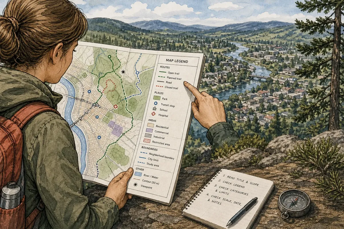
The most common map-reading mistake is treating the legend as decoration and guessing what the symbols mean. That can send you toward a trail that is closed, make a shaded district look like a danger zone, or turn a planning boundary into a supposed street. A map legend is a reading key: check it before you interpret the picture.
That habit matters whether you are looking at a transit map, a trail map, a flood-risk map, or a neighborhood plan. Work through the map in order: identify what it covers, match its marks to the legend, then check the categories and limits before drawing a conclusion.
Start with the map’s title and scope
Read the title, subtitle, and any date or source line before decoding individual marks. A map headed “Proposed bike network” does not show the same thing as one titled “Existing bike lanes.” A storm map may describe a forecast, a past event, or a modelled area; the title and notes should say which.
Next, establish the map’s scope. Look for the geographic area, time period, and subject. A transit diagram may leave out street distances to make connections easier to see. A land-use map may show zoning rather than what currently stands on each parcel. The image can be precise in appearance while answering a narrower question than you first assumed.
If the title is vague, look around the frame for a subtitle, date, scale, source, or explanatory note. Treat missing context as a reason to pause, not as permission to fill in the gaps.
Find the legend and match marks carefully
Locate the legend, often placed near a corner, beside the map, or in a separate panel. Scan its full set of entries before focusing on the symbol you noticed first. The nearby items can reveal a classification system: several line styles may distinguish routes, while several shades may represent ordered categories.
Match the symbol’s shape, color, pattern, and line style—not just its most vivid feature. A dotted blue line and a solid blue line may refer to different kinds of waterway or route. A filled circle and an outlined circle can indicate different places even if both use the same color.
Trace the mark from the map to the legend and back. If a symbol changes appearance where lines meet, inspect the legend for separate entries such as “route,” “transfer point,” or “station.” Do not assume that two similar marks share a meaning.
When a map has no visible legend, check for labels or notes that define its symbols. If you still cannot identify a mark, keep it unresolved rather than assigning it a familiar meaning from another map.
Read categories before reading color
Color is memorable, but the category attached to it does the explanatory work. A sequence of pale to dark shades may represent increasing elevation, different land-use types, or a set of administrative zones. The same color has no fixed meaning across maps.
Read the category names and their order. For a shaded map, see whether the legend describes ranges, named classes, or a simple distinction such as “inside” and “outside.” Then check how boundaries are drawn. A dark fill may mark a selected area, not a higher value or greater risk.
Pay attention to what the legend leaves out, too. A map that classifies only “high,” “medium,” and “low” does not necessarily tell you what happens within each class. A blank area might mean “not mapped,” “no data,” or “not part of this category.” Look for an explicit label rather than treating empty space as zero.
Check lines, boundaries, and overlapping symbols
Lines often carry several kinds of information. A solid line might mark a road, a dashed line a planned connection, and a heavy outline a district boundary. Follow each line style in the legend and compare it with the line on the map. Where two lines cross, do not assume the crossing is a junction; one may simply pass over the other as a boundary.
Boundaries deserve particular care. A boundary can show a service area, a jurisdiction, a study zone, or a proposed limit. Those are not interchangeable. Read its label and any note explaining what the line encloses.
Symbols can overlap when the map is crowded. If a marker sits on a colored area or directly on a line, check whether the legend separates point symbols from areas and routes. The map may be showing several layers at once, not one combined symbol.
Check scale, date, and notes before acting
The legend explains marks, but other map furniture helps explain how much you can infer. A scale bar or scale statement gives a sense of distance; a north arrow or orientation note helps establish direction. A transit map may deliberately distort distances, while a local street map may be designed for closer spatial comparison.
Check the date and source notes, especially when the map concerns closures, construction, services, hazards, or changing boundaries. A symbol may be clear while the information it represents is out of date. Look for notes about exclusions, simplified features, or data that were unavailable.
Say you are using an invented neighborhood map to choose a walking route. Its legend shows a dashed line for a planned path and a solid line for an open path. If you first notice a dashed shortcut and assume it is available, you may plan around a route that does not yet exist. Matching the line to the legend changes the sensible choice: follow a solid route, then check the map’s date and any access notes.
Why does the map legend change what the picture means?
What should I check first in a map legend?
Start with the legend title and category labels, then match the exact symbol style to the map. Check whether the key distinguishes colors, line patterns, shapes, and filled areas.
Do the same colors mean the same thing on every map?
No. A color can stand for a route, a land category, a value range, or a highlighted area depending on the map. Use the labels and notes on that map rather than importing a meaning from another one.
What does an empty or unshaded area mean?
It depends on the map’s categories: the area might be outside the mapped subject, lack data, or belong to an unmarked class. Look for a “no data,” “not included,” or similar entry before interpreting it as none.
What if a symbol is missing from the legend?
Check the title, captions, labels, and notes for a definition. If the meaning remains unclear, treat the symbol as unknown and avoid basing a decision on a guess.
Make the legend your first stop
Before you describe a map, point to the legend entry that supports your reading. That small pause helps separate what the map actually marks from what its colors and shapes merely suggest at a glance. For any map, the legend is not an accessory to the picture; it is the key that makes the picture readable.
When a category affects a real decision, such as access, boundaries, or a possible hazard, confirm the map’s scope and current notes as well as its symbols. A clear legend tells you what the marks mean; it does not make every mapped detail complete or current.